The Canada
Alaska Highway – Alcan – stretches for 2,288 Kms from Dawson Creek (British
Columbia, Canada) through to Delta Junction, (Alaska USA). It was after the
bombing of Pearl Harbour in 1941 that construction of a highway was deemed a military
necessity as a supply road to defend North America against the Japanese. More
than 11,000 American troops, 16,000 civilian workmen (from Canada), literally
carved out the road from the wilderness in eight months (from March to
September, 1942). They averaged eight miles of road a day.
 |
| Start of the next adventure |
So Dawson
Creek has a Mile Zero Cairn and using a publication called Milepost we are able
to track every point of interest along the route.
 |
| Mile zero marker |
The first
hundred kilometres of the Alaskan Highway winds through lush farmlands of the
Peace River District. Natural gas was first piped from here in 1957 and the
area is rich in natural resources; oil, gas, timber, pulp, hydroelectricity and
agriculture. It also has thousands of acres of pristine wilderness with plenty
of wildlife. The road was easy travelling and there was plenty of truck traffic
and RV holiday makers. We camped that night at Fort St John in a Rotary RV Park
on Charlie Lake - great opportunity to display achievements of the local Rotary
Club.
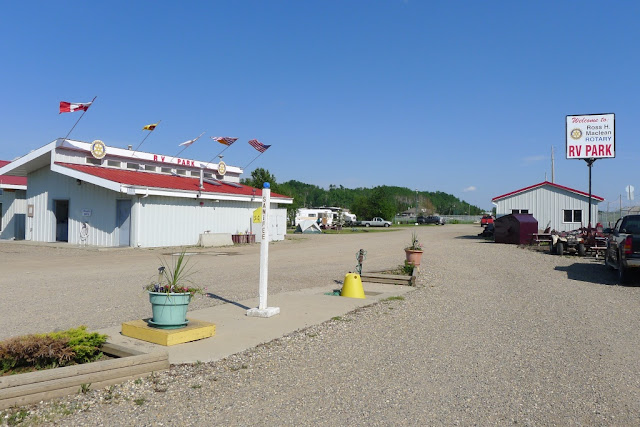 |
| The local Rotary Club own the park and lease it out over summer - great income and a good way to publicize Rotary |
After Fort
Nelson the road is considered the most scenic as it heads into the northern
Rockies.
 |
| The long and winding road... |
It follows the river canyons with magnificent folded mountains and
river views, and then skirts the shore of blue/green Muncho Lake for about 12
kms.
There were many camps along here, with places to fish and hike.
 |
| Sawtooth Mountains |
We were
also warned to watch for animals and the day we were here we saw a grizzly
bear, a black bear, (both too quick for photos), a herd of Woodland Bison with
lots of calves, many Stone Sheep, an elk and a moose.
 |
| The locals say that there are only two seasons in the north, winter and the road construction season |
 |
| Muncho Lake view |
So we’ve ticked off most
of the animals we’d hoped to see – but still haven’t seen a wolf.
 |
| Woodland Bison roam freely along the side of the road |
 |
| You never know what is going to come out of the forest. This is a female elk. |
 |
| Stone Sheep |
A small
private campground at Tetsa River bakes large world famous cinnamon buns, so
afternoon tea went on long enough to stay the night.
 |
| Great cinnamon buns - but that beard - now that is something to strive for. |
So we
arrived about lunch time at Liard Hot Springs, one of our favourite camps.
 |
| Great Provincial Park campground at Liard Hot Springs |
It
was the site of a major construction camp in 1942 and now the provincial parks
have built a boardwalk to the springs – and they are hot, too hot for swimming!
We spent some time in the water and had to move downstream a bit.
 |
| The spring comes out at the far end at about45C and gradually cools off as it gets to the lower pool. |
Standing in
the water, the bottom of the stream is cooler and the top layer of water is hot.
We could feel the definite thermal layers.
 |
| Welcome to the Yukon |
The
information centre at Watson Lake is surrounded by a “signpost forest”.
 |
| Signpost Forest at Watson Lake |
People
have been adding them since the construction of the highway. At the last count
there were 72,000. We did see a number plate from Tasmania.
 |
| Lots of big rivers - lots of big bridges |
Most of the
bridges have metal grating surfaces. Teslin Bridge spans the Nisutlin River and
the camp was on the edge of the lake.
 |
| Bridge at Teslin |
This site was one of the original lodges
on the Alaska Highway with abundant wildlife (and fishing) in the area. There was
a wonderful collection of “stuffed” animals in the complex too.
 |
| "Stuffed" sheep |
 |
| The real thing - note the goats in the background |
The mozzies
were pretty fierce here but the sprays worked well when we were out of doors.
 |
| Tlingit Heritage Centre Totem Poles |
The Tlingit
Heritage Centre had a large hall and showcased the history of the First Nation
People from the area, which we found very interesting. There were a series of
totems representing Wolf, Beaver, Eagle, Frog and Raven Clans.
George Johnston,
a Tlinglit Indian, was known for his fine photography capturing the lives of
his people between 1910 and 1940 and the video of his life gave us a good
insight of his people.
 |
| George Johnston had the first car in Watson Lake in 1928. He floated it in on a barge. There were no roads so he and his family cleared a road and he gave rides to family and friends. He painted the car white in the winter and drove it on the lake for ice fishing |
So at almost
888 miles (1430 kms) from cairn zero miles, we were in the biggest city of the Yukon,
Whitehorse, on the upper reaches of the mighty Yukon River. The city nestles on
a flat area on the western edge of the river, with abrupt escarpments on either
side of the river, while the airport sits above the city on the “mountain top”.
 |
| Great wind vane - the whole plane swings around with the wind. |
 |
| Just the thing for those rough roads when the Alcan higway was first opened in the '40s. |
From
Whitehorse to Dawson City we followed the mighty Yukon River, stopping a night
at a rest area above Five Fingers.
 |
| The walk to Five Fingers lookout at the island in the river included 230 steps down but it felt like a lot more coming back up. |
The conglomerate rocks used to cause big
navigating problems with the sternwheelers travelling the river.
 |
| S.S. Keno sternwheeler at Dawson City |
|
We walked down
to the river the next morning – our hike for the day.
 |
| This person obviously didn't appreciate the majesty of where they lived. |
 |
| Diamond Tooth Gertie's Gambling Hall |
Sleeping can
be a problem with the sun shining for more than 20 hours a day and the sky
never getting dark.
 |
| Klondike Kate's Restaurant |
Life goes on at a
furious pace with only about 90 days frost free each year. The locals who spend winter here told us that
it is just like another world, with temps going as low as -40*C.
Some
literary greats have lived in Dawson City including Robert Service, Jack London
and Pierre Berton.
 |
| Robert Service's log cabin in Dawson City |
We likened Robert
Service to AB Paterson in the way he writes about the happenings on the
goldfields - the characters, the humour and the lifestyles. (Google him-"The Cremation of Sam McGee".)
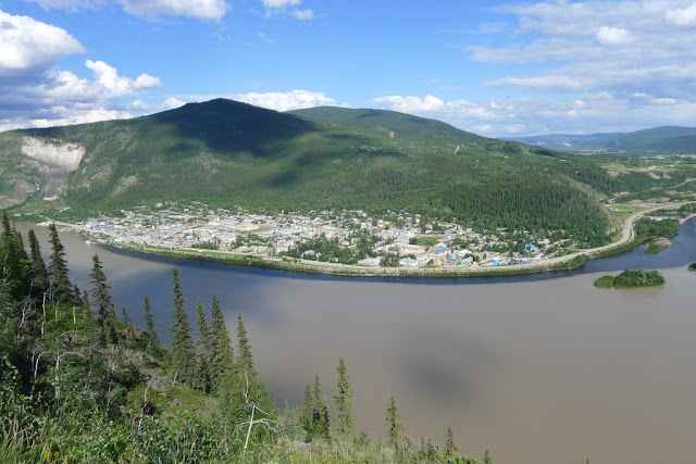 |
| Overlooking Dawson from the road to the Golf Club. The Klondike River joins the sediment laden Yukon River on the right hand side. |
It
is mainly gravel and closed in winter.
It is called “Top of the World” highway and I guarantee we will never
forget this adventure.
 |
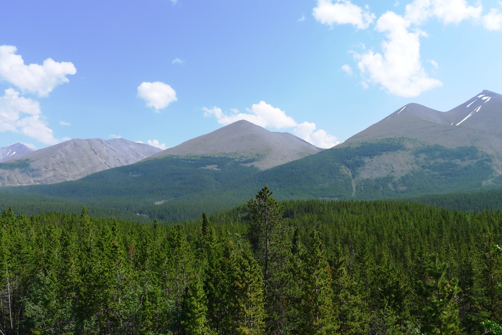
| "Top of the World" views |
Unlike most
highways here, which follow valleys in mountain ranges, this road winds its way along
the top of the range, often above the tree line, giving exhilarating views and
a unique scenic drive for about 100km.
 |
| View from the Top of the World Highway |
We experienced endless views of mountains and valleys in all
directions. It is truly a “road less
travelled”.
 |
Canada-USA Border Post on the "Top of the World" Highway
Little Gold Creek, Yukon
Poker Creek , Alaska |
The US end
of the road has far more potholes, was dusty and generally made travelling
behind other RVs and trucks very unpleasant.
Tok was back
on the Alaska Highway – a good camp to give Connie a scrub down and wash away
the dust. And 100 miles along the road was Delta Junction – the end of the
Alaska Highway.
 |
| "Official" end of the Alaska Highway at Delta Junction |
Another photo before heading for Fairbanks – but that will be
next time.


Yes, that Top of the World highway is something else. I would only ever do it once! Great photos!
ReplyDeleteThanks Trish,
ReplyDeleteDon't know how the "gap" appeared in the middle. A couple of friends commented. Hopefully I've fixed it. Please take another quick look and let me know if it's all OK.
Jen
PS I will check out your signed name suggestion